Ronnie's Walk Across Wales
- ronniesramblings
- Aug 4, 2025
- 10 min read
Updated: Aug 7, 2025
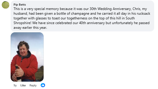
After the sudden loss of her beloved husband Chris in 2015, Ronnie found herself at a crossroads, grief weighed heavily yet a spark of determination flickered beneath. With her daughter living in Tywyn, Ronnie decided to do something extraordinary and endeavoured to walk from her home in Llanymynech to the Welsh coast, one step at a time.
Every winter Chris and I have walked a fairly local, longish distance path, usually one day at a time. Whilst most of them have been already way marked and possibly have a guide book eg. Maelor Way and Wat’s Dyke, some of them have been ones we have made up or are not particularly well way marked. Last year we tried to devise a route from our house in Llanymynech to Anne-Marie’s house in Tywyn, but Chris got a bit despondent about the fields with no exits and other blockages to marked rights of way on maps, so we didn’t get very far.
Then I realised that we could walk to Welshpool along the canal, pick up Glyndwr’s Way and follow that to Machynlleth, but that was too easy. Having given it a lot of thought I think it is possible to walk to Welshpool not entirely along the canal, only some of it, from Welshpool to Llanfair Caereinion, Llanfair Caereinion to Brigand’s Inn, pick up the Dovey Valley Walk to Machynlleth and thence along the coastal path to Tywyn, but if the coastal path doesn’t go up into the hills to what looks like a fabulous ridge walk into (nearly) Tywyn then I shall include the ridge walk rather than the coastal path. Anyone who has been up Tarren Hendre will know the ridge walk I mean.
So last summer I started out, walked across the fields to the canal (part of Chris’s Bods walk), the canal to Four Crosses, Four Crosses along Offa’s Dyke path to Pool Quay. But didn’t get to Pool Quay as Sky decided to have a falling out with a baby bull. Anyway, now she is better and I have someone to accompany me on the Four Crosses to Pool Quay bit and I have planned to walk from Raven Square in Welshpool to Llanfair Caereinion over the Easter weekend, thinking that would be the earliest the railway will be open and I can travel by train back to Raven Square

30th May 2015
Today I started my walk from the English Border in Llanymynech across Wales to Tywyn. I walked from home across the fields to the aqueduct and back along the canal to go under the A483 and come up the steps from the Border. Basically, Chris’ Bods Walk.
31st May
Drove to the aqueduct, walked along the canal to Parson’s Bridge and then onto Four Crosses to find where Offa’s Dyke leaves the village, went slightly off course and probably walked a mile further than necessary but found it in the end! Altogether walked 4.67 Miles in 3 hours 7 minutes!
6th June
Four Crosses to Pool Quay with AM. Parked my car at Pool Quay and drove back to park in the vet’s car park in AM’s car. Very flat walk AM asked if Offa’s Dyke was all this flat and I was able to tell her “No” and give many of the hills and indeed “mountainous” areas! Unfortunately, there were too many fields with cattle of one sort or another and everything ended in disaster at the almost half way point! See my letter to the footpath officer.


16th February 2016
Back on the trail again and at long last. This time with Simon, one car at Pool Quay and another at the Church in Four Crosses. Cold, slightly windy dry day but dry and sunny. Out on the Dyke and across the argaes, the ground had dried out quite a bit but a bit muddy in places. No COWS but quite a few sheep, not a problem!
Going through the dairy yard you are reminded of the Oswestry to Newtown Cambrian Railway, but only if you use your imagination!
After crossing the B4393 going to Llandrinio we were walking on the Dyke itself until we arrived near the sluice gates. After that we were walking on an embankment, they were the argaes built to keep the river off the fields. Nearing Pool Quay we came to several fields with sheep who were very wary of Sky.
Shortly before the last field we again came across the railway, the remains of the track bed was quite clear and of a bridge. We also saw what we think was navigational aids for the training helicopters from Shrewsbury.
We arrived at Pool Quay, very pleased with ourselves, but very muddy!


19th February
Pool Quay to Buttington.
After Tuesday a very gentle two miles there (and two back!) with Sandra. Parked at St. Johns Church which has two amazing bells holding up a bench- probably worth a snoop at some stage!
Otherwise apart from the lambs nothing totally surprising, just lots of chatter!
Nice clean path as well!
29th February
Buttington to Tesco’s Bridge Welshpool.
Just me and Sky. The previous walk was accompanied by the sound of traffic on the A483 this became diminished by the factories acting as a buffer just after Buttington Bridge. Here the difference was the gentle hum of the factories. Otherwise an uneventful mile or so.
5th March
St Piran’s Day
My personalised prize arrived from OS today, exciting!
8th March
Canal Wharf to Raven Square.
Me, AM and Sky and a very damp drizzle!
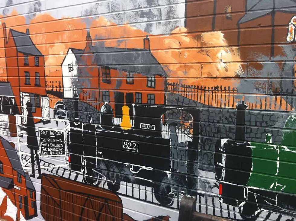
More or less straight through Welshpool but not up the main shopping street but past the TIC across the road, followed what might be Union Street past the library-detour for the mural of the town and trains-then into Brook Street-with another detour to look at Camper Vans and a Bubble Car! Wayne the Signwriter has his workshop in an old quarry here and the Armoury must have some sort of military background.
Only 0.93 Miles but very entertaining and of course more or less following the Llanfair C/Welshpool Narrow Gauge Railway line.
AM and I then walked down through the main town, she says we should have gone this way but there were too many distractions on the way back!
Good Friday
12.45 Miles
Having invited anyone from Bods to come with me from Welshpool to Llanfair C, Nick, Mrs Gizmo and Tess joined me at Raven Square to walk to Llanfair C and come back by train.
I thought the walk to Castle C would be well signposted as the railway actively promotes it. It wasn’t good but not that bad, Nick was very good at map reading!
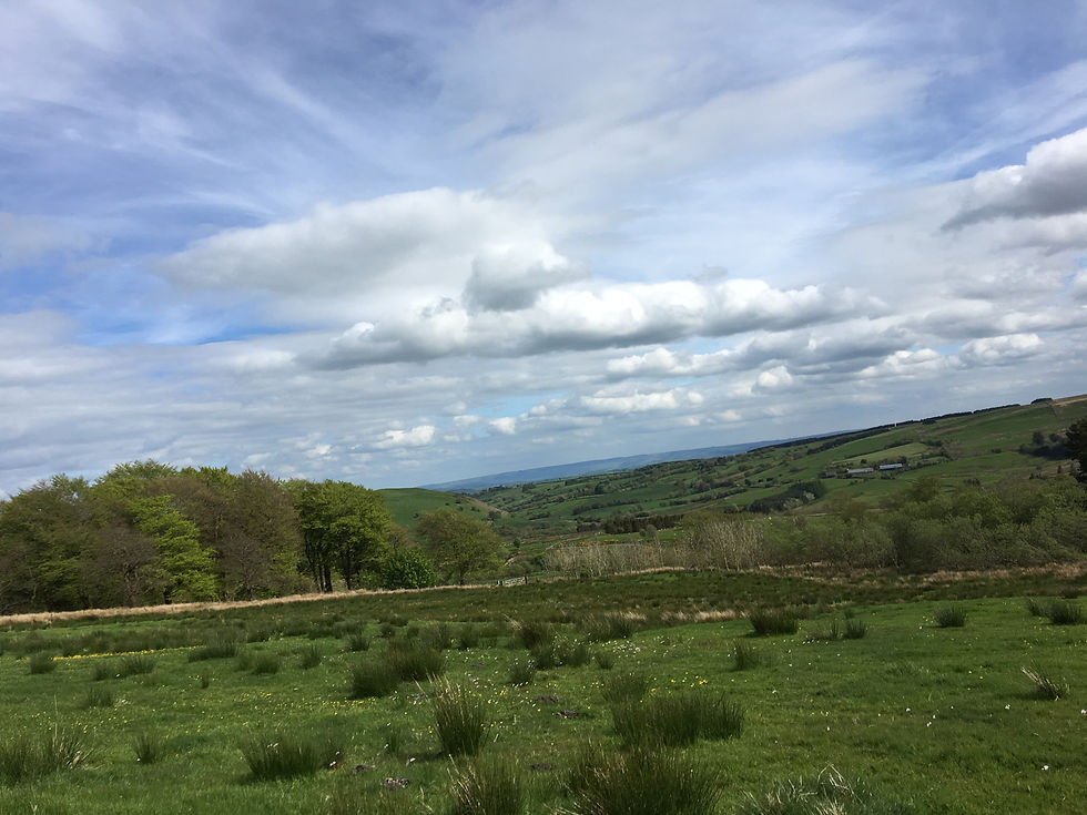
It was thought that it would be easier to follow lanes than the walk I had found so off we set again. By gum! It was a long long long hill up! But worth it, the views today were astounding, Cadair Idris but not Pen y Cadair, the arans, the Arenigs with Carnedd y Filiast visible behind. The Berwyns with snow still on them, Panorama above Llangollen, The Wrekin, The Brieddens, down to the Stiperstones, probably Plymlymon if I knew what it looked like!
I should mention that the weather was outstanding. Blue non-haze sky was ours all day! Quite a strenuous walk of 12.45 Miles in just 4 hours 44 mins! But just in time to go to the loo, have a cup of tea and catch the train back. Wonderful! Thanks Nick, Kathy, Gizmo and Jess!
21st April
Shakespeare’s 400th Birthday!
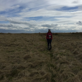
Parked in the gateway to an old quarry and walked back to where we walked down a very straight lane connecting us with the road into Llanfair C. Started from here, heard but didn’t see Curlews at least twice. Also Buzzards. Arrived back in the car and had lunch, then walked onto Cefn Coch. Views still amazing but not as good as Friday but I didn’t realise that what I saw as Panorama above Llangollen was actually Llanymynech Hill!
Weather was good with a very chilly wind at times. Busy road! Just as well we were walking on the roads-lots of sheep in the fields with of course their fun loving lambs! Sky behaved very well on encountering other dogs considering the other dogs barking behaviour!
Walked from the outskirts of Cefn Coch to the junction leading to Red Ridge. Lots of lambs and I’m not sure of which direction to go. Whether on to Red Ridge or across the fields. I decided caution was the best form of valour and went back to the car!
Many weeks later…
Eventually had some advise from one of the staff, Rob, at Red Ridge and eventually with the help of AM we managed to get to Nant y Eira!
13th May 2017
AM agreed to come with me across from Cefn Coch to Nant y Eira. We set off following the pine wind break and managed to navigate the wrong way but ended up on the road to Red Ridge. So I decided we would try and follow Rob’s vague directions. We managed to follow them okay until we reached the end of two woods/forests. He had said just follow walls and fences to Nant y Eira but he was vague – I think it was probably a long time ago that he had come this way.
We walked up to a high spot following quite a good path/track through the moorland and when we had good views I decided where we should be going as far as it was possible.
So we set off following fences, crossing them if necessary or using gates. We got half way across one field and couldn’t see a gate in the direction we were going so we went up to a gate we could see and back tracked to where we wanted to be only to find there was a gate from the original field into a sheepfold!


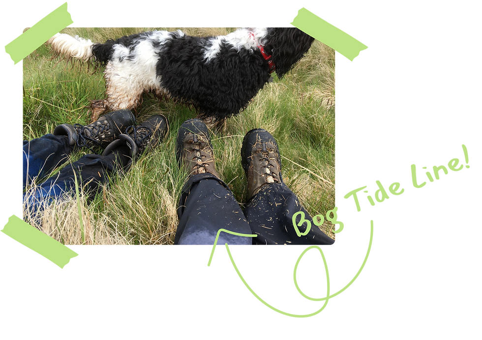
AM got a bit tetchy at this point but got even techier on the way out of the field- we had to cross a very wet patch almost a bog, AM’s temper soared to boiling point, she had to stop in the middle of the bog for a pee, she couldn’t squat because of the rushes, I have an imprint on my brain of her standing thrusting her bum out and wittering very loudly as she starts sinking further and further into the bog! She should be glad I didn’t take a photo!
On reaching the edge of the bog on a rise up to a wall she threw herself at the bank face down and found two dogs using her as a way out of the bog! Not a happy lady! Fortunately, she quickly saw the funny side of life!
We stopped again for five minutes or so to try and gain our equilibrium and a good look at the map. Since leaving the high point the ground had been very very rough (if not damned boggy!) this was to carry on for the next few fields. I tried to explain to AM where we were and where we should be going but she had no confidence in her map reading skills and just made encouraging noises!
I must say I was just losing confidence in my own map reading skills, a large conifer forest was marked on the map but its shape was quite different. We should have seen or had some knowledge as to where two small Llyns were at the beginning of the walk. One of the reasons for being displaced was no forest/wood wind break marked on the map, by its growth I would say it was between 10-15 years old but my new (2015) OS map didn’t show it as did my 1999 OS Map. In fact there appears to have been no updating from 1999-2015. There was at least one mast we could see most of the day and at the beginning of the walk two air turbines. Never mind about woods or trees or the shape of the forest altered!
Fortunately it was a clear day, dry not too warm or windy day.
We climbed out of the bog (field) over a fence and contoured around the next field above a stream but through the gorse, smelling today of coconut. Across another boggy bit and over a wall uphill to-a track! I explained to AM that I could not be completely sure where I was in relation to the forest we had just basically walked around for the last two (?) hours and that its direction was taking us out of our way at least to begin with.


I would rather go through a field heading west, but I think we were both rather fed up with the extremely rough terrain. So we set off along the track-it was the right decision as from here on I knew where we were even if initially heading in the wrong direction!
Eventually the rough track became tarmac, none of the houses/farms had name signs but I was sure of where we were, we probably walked two miles in the wrong direction but we had known where we were-some two hours later we arrived at AM’s car!
In retrospect if I had micro navigated the first bit we may have gone in the direction I wanted and not walked so far but everything is easy in hindsight!
Having studied the OS map and Google earth before embarking on this stretch I knew it wouldn’t be easy, with no or very few tracks or well walked paths never mind about Rights of Way or Bridleways- but we made it-thanks AM!
Sadly Ronnie didn’t finish her walk across Wales, but what she did accomplish was far more meaningful than miles on a map. After losing her husband Chris, she set out from Llanymynech with a heart full of grief and a sense of humour that would carry her through bogs, brambles, and baffling footpaths. Though she didn’t reach Tywyn on foot, she reached something deeper, connection, healing, and joy. Those who walked with her, even just in spirit, were lucky to be part of it.

Footnote
An Argae (as mentioned in the section between Four Crosses and Pool Quay) is the Welsh word for embankment
The final section which I walked with Ronnie was sold to me as a 5 mile walk...it ended up being 11.5!!!!
Red Ridge is an outdoor centre at Cefn Coch which Chris worked with for many years
Total Miles (approx) 42


Comments